The Iowa Geological Survey is undertaking a comprehensive five-year project to survey and assess Iowa's 900 miles of levees using cutting-edge geophysical technology, an important precautionary measure to ensure flood protection is ready for the next natural disaster.
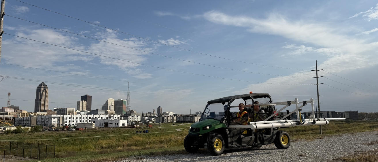
Using an electromagnetic terrain conductivity meter uniquely mounted on a utility terrain vehicle (UTV), researchers are collecting detailed subsurface data to identify potential vulnerabilities in the state's levee systems.
"We're scanning these levees to figure out where the problems are going to potentially occur before they occur," said Jason Vogelgesang, the lead researcher and a geophysicist at the Iowa Geological Survey, based at the University of Iowa College of Engineering.
The project, which was initiated in collaboration with the Department of Homeland Security's Office of Levee Safety, follows a strategic approach. In the first year, the team surveyed 100 miles of levees, increasing to 200 miles in the second year, with plans to continue at the same pace through year five.
The team collects five readings per second using specialized equipment mounted five feet from the vehicle to minimize metal interference. They identify potential issues by flagging "anomalous areas" based on conductivity measurements, which can indicate variations in subsurface materials.
"We're not flagging them as problem areas," Vogelgesang noted. "We don't know that they're a problem until somebody comes back and investigates what the particular anomaly represents."
After the geophysical survey, another UI institute – IIHR—Hydroscience and Engineering – will conduct follow-up engineering investigations on flagged sections to determine the specific nature of any potential issues.
The project prioritizes levees across different geographic regions and maintenance conditions, working from a list provided by the Office of Levee Safety. This approach ensures a comprehensive assessment of the state's critical flood protection infrastructure.
While the survey doesn't directly address maintenance, it provides crucial data for local municipalities and state agencies to understand and potentially improve levee conditions.
As the project continues, it represents a significant step in proactively managing Iowa's flood protection systems, using advanced technology to look beneath the surface of these critical infrastructure elements.


